| News Details |
Evaluation and classification of lands for a part of the Right Euphrates project in Anbar province using geospatial technologies
2022-06-26

Alaa Yaseen Muhammed
Remote Sensing-University of Baghdad
Remote sensing is one of the latest inventions in the world of modern technology, and is appointed to detect the earth's mysteries from broadband space, this method is based on measuring reflections Electromagnetic radiation returned, from natural resources buried deep, or scattered on the lands, or by measuring the radiation emitted by these resources. It is also possible through these means to monitor the natural resources and notice the defects or richness of them. The removal of vegetation can be monitored, as well as the movement of sand, the drying up of water bodies, and the sinking of water from the depths. There are several definitions of the term remote sensing, all of which revolve around a basic concept, which is the collection of information and data from a distance. Land suitability classification is a method for assessing the soil, developed by Food and Agriculture Organization (FAO). FAO has stated that land suitability is the appropriateness of a particular type of land for a specific use. It can consider the current condition of the land or after improvements. The process of land suitability grading is the evaluation and classification of specific areas of land in terms of their suitability for specific uses. The right Euphrates project is located in the lower part of the Euphrates River basin within the flood plain of the Euphrates River according to the the main and secondary physiographic taxonomy of Iraq that presented by (Buringh, 1960). Near the Euphrates River and to the west of the Fallujah city within (path 169 and row 37) of the European satellite 2. Sentinel. The project is located within the boundaries of the Fallujah district and is about 3 km away from it to the west between the longitude (37.43° - 50.43°) east and the two latitudes (33.09°-33.-22 °) north. The northern part of right Euphrates was chosen. The area of ??the study is (5359) hectares. The Right Euphrates region is classified as a semi-desert region (sub desert zone). The entire area of ??Right Euphrates project is under the free irrigation system, as well as irrigation by pumps from the Euphrates River, which flows into irregular and unlined channels.
The lands of Right Euphrates were classified according to their productive capacity using remote sensing technology and geographic information systems into (8) classes, from the first category, which represents the best type of lands very suitable for agriculture, to the eighth category, which is not always suitable for agriculture. According to the modern American classification system, the main reason for the variation in the classes for the study area is due to the variations difference in evaluating the land from one region to another, the difference in the topography of the region, and the variation in water sources, as the classification of land has an important role in knowing the type of land use for each land class, and if we dive into the study of all land classifications we find that each category has a specific use in agriculture (Figure 1) (Table 1), where the land is divided according to its use to:-
1. Class I, II, III, and IV: It is preferable to use it to grow field crops in a descending manner as they are arrived.
2. Fifth and sixth class: Preferably used for cultivation of perennial pastures.
3. Class VII: It is best used in forests, afforestation and bushes.
4. Eighth class: Its best use for nonagricultural purposes. Its area is very small, and this species needs to spend more time, effort and money in order to exploit it for agricultural purposes.
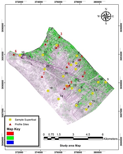
Figure 1. Part of a satellite image of the Right Euphrates region
|
Area |
PER% |
Classification |
N |
|
11.94 |
0.2 |
Class 1 |
1 |
|
82.39 |
1.53 |
II Class |
2 |
|
645.07 |
12.04 |
Class III |
3 |
|
1399.68 |
26.12 |
Class IV |
4 |
|
1589.16 |
29.65 |
Class V |
5 |
|
1396.30 |
26.05 |
Class VI |
6 |
|
233.24 |
4.35 |
Class VII |
7 |
Table 1. Areas of the land types in the Right Euphrates region

Figure 2. Right Euphrates land classification
Conclusions and Recommendations:
1. Conducting land evaluation according to the (SYS 1993) formula as being compatible with real land suitability for agriculture
2. Follow the method of classifying the land used in this study, as it is consistent with the ground facts of the class of land that was observed during the field visits.
3. The study also recommends the cultivation of field crops, wheat and barley for the first class lands near the Euphrates River, and the cultivation of citrus fruits.
4. The lands with low reflectivity rates are the lands whose land are within the first, second and third classes, with the confirmation of field visits and laboratory analyzes.
5. The use of modern means in remote sensing technologies such as drones equipped with visible and near red (NIR) channels to determine the type of land after studying and analyzing the images produced.